At the Kaiserstuhl-Tuniberg, one can discover, through 8 thematic paths and a brand new hiking scheme, the particularities of this cultural landscape. The separate towns are linked together by the thematic paths and the hikers will be welcomed by informative entrance portals. These thematic paths have been incorporated to the existing path network (symbol: yellow diamond shaped blaze) in cooperation with the Black Forest Association. A multitude of combination possibilities are thus offered to the hiker:
The Kaiserstuhl thematic paths
Quality trail Kaiserstuhlpfad (21,7 km)
(Endingen – Erletal – Katharinenkapelle – Eichelspitzturm – Vogelsang-Pass – Neunlindenturm – Eichgasse – Vogtsburg-Bickensohl – Jägerbuck – Dulltalhütte – Lenzengasse – Ihringen.)
Neunlindenpfad (16,8 km)
(Ihringen - Neunlindenturm – Eichelspitzturm – Katharinenkapelle - Endingen)
Steinkauzpfad (17,9 km)
(Wasenweiler – Bötzingen – Eichstetten – Bahlingen – Riegel)
Wiedehopfpfad (31,5 km)
(Breisach – Achkarren [Stn.] – Oberrotweil – Burkheim – Jechtingen – Sasbach [Limberg])
Knabenkrautpfad (21,5 km)
(Breisach – Ihringen [Martinshöfe] – Ihringen [Lilienhof] – Bötzingen)
Kirschbaumpfad (18,4 km)
(Sasbach – Leiselheim – Kiechlinsbergen – Amoltern – Endingen – Riegel)
Katharinenpfad (12,6 km)
(Oberrotweil – Katharinenkapelle – Bahlingen)
Badbergpfad (14,9 km)
(Oberrotweil – Oberbergen – Eichstetten – Nimburg)
Bienenfresserpfad (16,1 km)
(Ihringen – Bickensohl – Oberrotweil – Bischoffingen – Königschaffhausen)
Burgunderpfad( 26,6 km)
(Munzingen - Merdingen - Gottenheim - March)
Local thematic and circular trails
Beside the route network, many circular trails await the hiker in different towns:
The Achkarrer Schlossberg- trail - Vogtsburg-Achkarren
The Brunnenpfad (well trail) - Bötzingen
The Geological trai -l Eichstetten
The loess-hollow-path trail - Vogtsburg-Bickensohl
The culinary wine trail - Vogtsburg-Oberrotweil
The fruit trail (Obstwanderpfad) - Endingen-Königschaffhausen
The Nature trail (Naturpfad) - Riegeler Michaelsberg
The Nimberg path - Nimburg
The green lizard trail (Smaragdeidechsenpfad) - Vogtsburg-Oberbergen
The Winklerbergpfad in Ihringen - (Vulkanfelsgarten)
The Holly hoopoe trail (Wendelin Wiedehopf-Pfad) - Ihringen (for families)
The Bobby the bumblebee trail (Hummel-Hertha-Pfad) - Ihringen-Wasenweiler (for families, also a bike path)
Trailblazing system:
A direction sign usually tells you which destinations can be found in different direction. This allows you to change your planned tour on your way. You can also obtain information on where you are situated. In order to allow you to know which direction sign you’ll have to follow, the Kaiserstuhl route network divides itself into two path categories, which are marked by different signs:
Local or rather Kaiserstuhl-wide
Hiking trails: yellow diamond shaped blaze
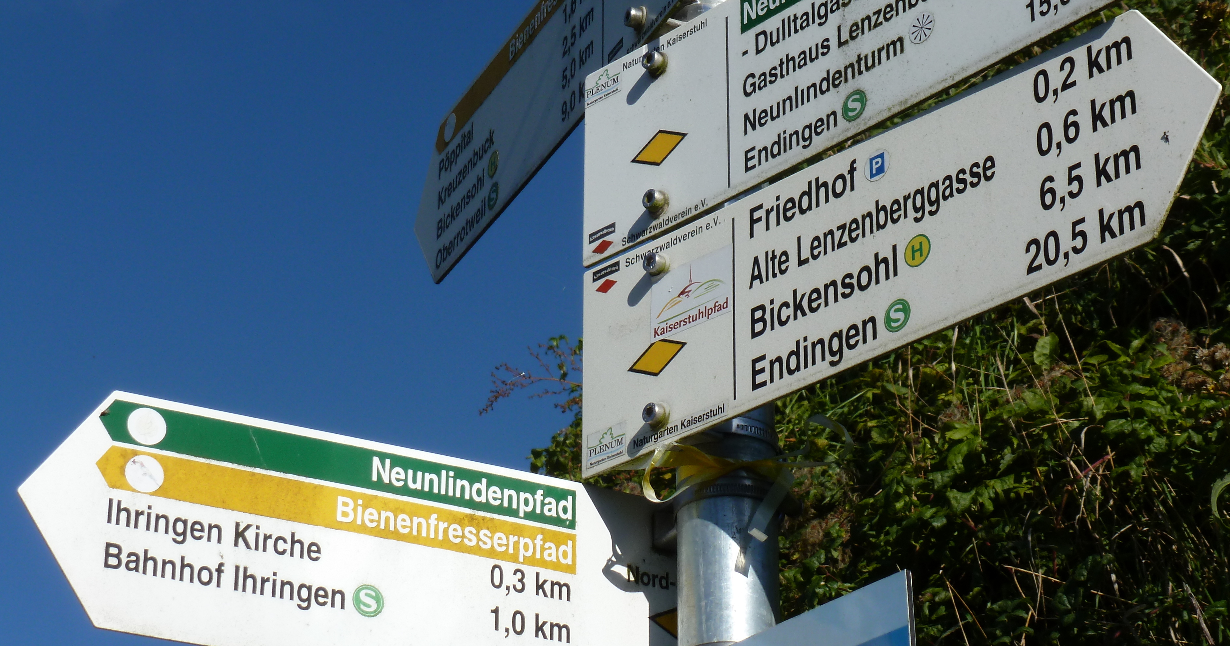
Signs: The near destination, name of the next village is written at the top of the sign. Destinations listed in-between are places of interest or other important hiking destinations.
The coloured line indicates on which of the 10 thematic paths you are. On the middle left is the name of the current location, the elevation data. Little logos indicate bus and train connections, viewpoints and restaurants.
Starting points: Entrance portals, equipped with maps and information on each location and the paths accessible from there, are present in the whole Kaiserstuhl and mostly situated at central points of the communes like train stations, town halls and parking lots.
Distanced hiking trails
Cross trail Rhine-Kaiserstuhl-Black Forest (Red diamond shaped blaze on yellow background)
Rheinaue trail Basel-Kehl (White diamond shaped blaze with blue waves on white background)


